
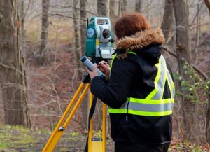
TOPOGRAPHICAL SURVEY
Effective planning for any development depends on precise topographic mapping that measures and details the surface of the earth and objects on it. If you are designing anything from a new garden to a new subdivision, you will find that a topographic survey is a necessary and very useful planning tool.
Topographic surveys are a vital element in the layout and construction of new homes. They detail natural elements such as creek banks, trees, and rock outcrops, and man-made on-site structures such as rock walls, driveways, fences and landscaping. Off-site features such as municipal services are also included in a topographic survey.Typically, plans are drawn showing the perimeter of the property, all data collected and interpolated contours. Our survey returns are in the form of plotted plans, digital files and photographs, and they can be sent to the client and architect in any specified format.
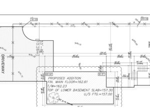
LOT GRADING PLAN
This type of plan shows the location of a proposed new building, including the proposed grade elevations around the property. The purpose of this plan is to ensure that the construction of the new building, including the construction of driveways and retaining walls, will be completed in such a manner so as to allow for proper surface drainage, and to prevent any negative impact on adjoining land owners.
A Lot Grading Plan is prepared and submitted to the municipality, usually at the same time that the architectural drawings are submitted for a building permit.
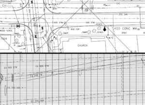
ENGINEERING SURVEY
Engineering survey is required for the design and construction of civil engineering project such as roads, railway,bridges, tunnels, landfill cells, landfill caps, mining, pipeline and quarry infrastructure. we help architects and building construction teams ensure that the projects progress according to their design, structures are built within given tolerances and comply with the quality standards and building regulations.
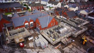
CONSTRUCTION SURVEY
Construction surveying or setting out is used to guide construction crews through the construction phase of a project. Markers are placed at key features such as manholes, street lights, utility boxes, bridge abutments building corners or gridlines. The markers will be set then a stake will be placed with key information such as the offset to the corner of feature and cuts or fills to design grades such as invert of manholes, gutter line of curb or main floor of building.
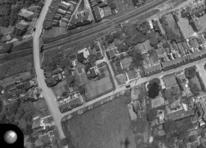
AERIAL MAPPING & PHOTOGRAMMETRY
Photogrammetry refers to the process of recording, interpreting and measuring from photographic images. At 3S VECTOR we use aerial photography to prepare plans and maps. The maps are used in planning and design of infrastructure such as highways, dams, mines, quarries, landfills and for development projects. The advantages of photogrammetry over traditional ground surveying are that it is the cheapest and quickest way of mapping a large area, there are no site access issues, the photogrammetric map is a record of features and levels at an instant in time; this is especially useful in rapidly changing sites such as mines, quarries and landfills.

UNMANNED AERIAL VEHICLE (UAV) SURVEY & APPLICATIONS
UAV’s have become the ‘go to’ method for mine site survey construction, mapping, planning and monitoring.
With our drones / UAV’s, 3S VECTOR can deliver an Aerial mapping photogrammetry data suite the next day. Manned flights often take weeks of scheduling and often longer to get the information back. We get the data to you fast so you can make qualified decision fast and with confidence.
Managers will find endless uses cases for visually communicating the site to employees, blast crews and contractors.
The deliverables and use cases include:
- DTM’s , DEM’s
- Survey grade Georectified orthographic imagery
- Contour lines, gradients, areas calcs & Triangle mesh (3d Dxf files)
- Volumetric calculations of stockpiles, cut and fill requirements
- Site lines & radio transmission.
- 3D models and fly-through animations